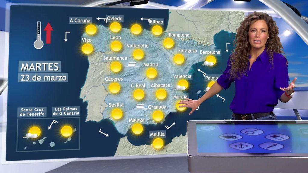
Suben las temperaturas hasta 8 ºC: el tiempo que hará en España el martes, 23 de marzo

Las temperaturas suben en toda España, sobre todo en Canarias y el interior peninsular
Las mínimas todavía serán bastante frías en zonas de la Península
Una irrupción de polvo sahariano afectará a las islas orientales de Canarias
El frío y el viento han ido amainando después de un puente de San José con tiempo bastante invernal para estas fechas. Acabamos de dar la bienvenida a la primavera y esto se notará especialmente entre el martes y el jueves, cuando las temperaturas van a subir hasta 8 ºC y los cielos van a estar azules en prácticamente cualquier rincón de España.
Tiempo estable y seco en toda España
MÁS
En casi todo el país se espera tiempo estable y anticiclónico, con predominio de cielos poco nubosos o despejados. Tan sólo se darán algunos intervalos nubosos en el este de Cataluña y en Baleares, quizá con algún chubasco aislado en Menorca. Intervalos nubosos también a primeras horas en el alto Ebro y norte de Canarias y al final del día en Galicia.
Se producirán brumas matinales en el interior de Galicia, alto Ebro y Cataluña, que podrán reaparecer por la noche.
Irrupción de calima en Canarias
Probables calimas en Canarias, especialmente en las islas orientales. En los días siguientes, avisa la Agencia Estatal de Meteorología (Aemet), el polvo en suspensión se expandirá hacia el oeste del archipiélago.
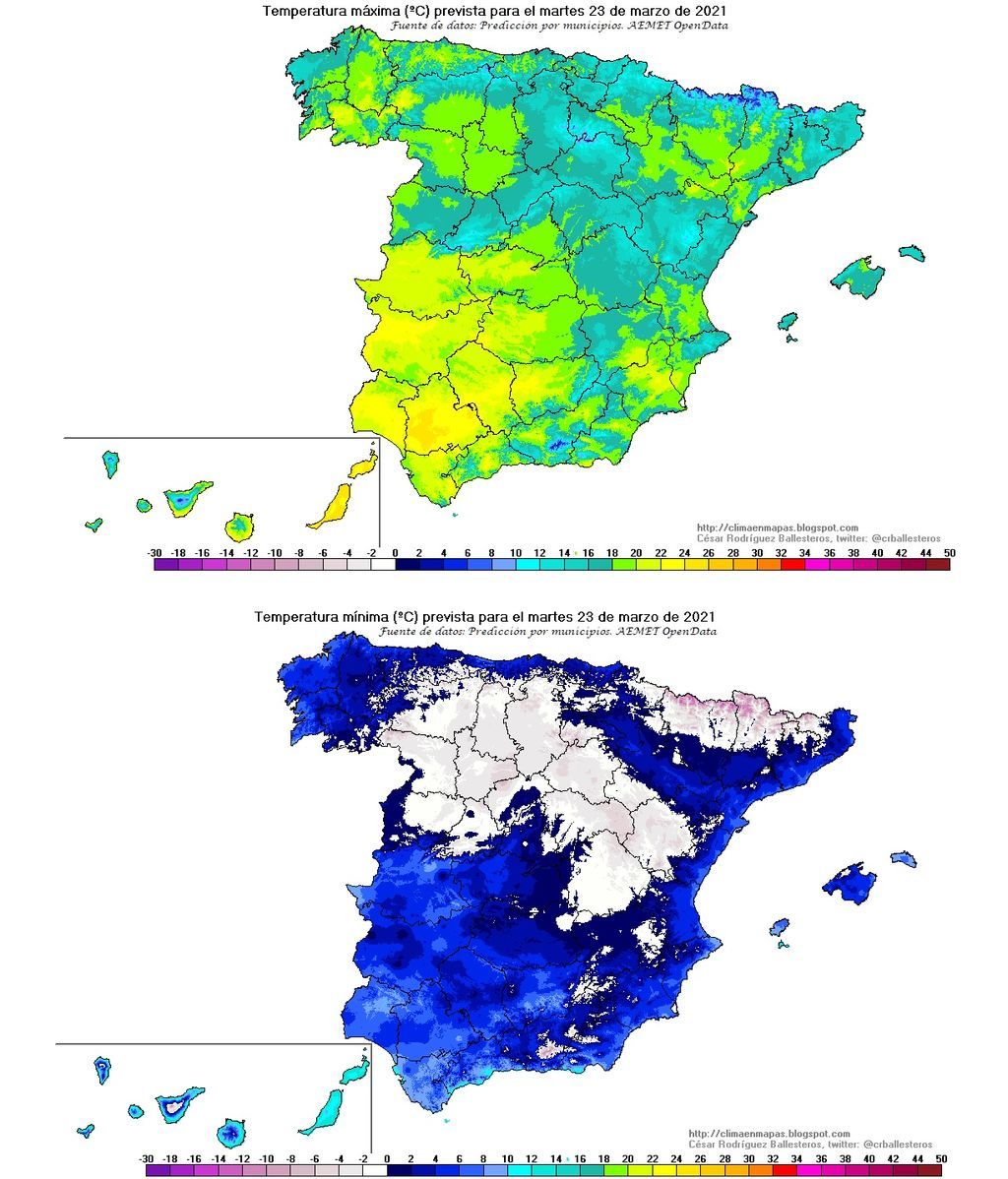
Se disparan las temperaturas máximas
Se espera un aumento de las temperaturas diurnas, más acusado en Canarias y en el interior peninsular, siendo notable en el extremo norte y Canarias orientales. Las nocturnas, por el contrario, bajarán en el cuadrante nordeste, meseta Norte y este de la meseta Sur, con heladas débiles en muchas de estas zonas, más intensas en Pirineos.
Viento puntualmente fuerte en Canarias
Los vientos amainarán considerablemente respecto a días anteriores, siendo flojos en general, adquiriendo componente este en el litoral cantábrico y componente oeste en el litoral gallego y andaluz.
En la primera mitad del día, todavía soplará del norte en el bajo Ebro, Pirineos, Ampurdán y este de Baleares, debilitándose después. En Canarias soplará el alisio, tendiendo a componente este en las islas orientales, mientras que en medianías y zonas altas soplará sudeste con intervalos de fuerte.